
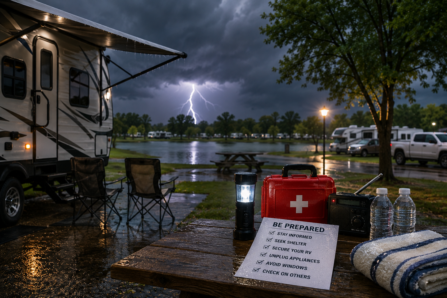
Kansas summer storms can shift from a calm, hot afternoon to genuinely dangerous conditions faster than most people expect, and late summer specifically brings its own set of hazards beyond the tornado risk most visitors already know to watch for. Knowing what you’re actually dealing with, and having a real plan before a storm arrives, is what separates a scary but manageable evening from a genuine emergency.
Kansas’s late-summer severe weather season brings a genuine mix of hazards — tornadoes remain a real possibility through much of the summer, but derechos, a specific and often underestimated type of windstorm, are also a significant late-summer risk that deserves its own dedicated understanding rather than being lumped in with general “storm safety” advice.
What a Derecho Actually Is
A derecho is a widespread, long-lived, straight-line windstorm associated with a fast-moving cluster of severe thunderstorms. To be officially classified as a derecho, the National Weather Service requires a damage swath extending more than 250 miles, widespread wind gusts of at least 58 mph along the entire path, and at least three reports of wind gusts of 75 mph or greater somewhere along that path. Some derechos have produced gusts as high as 130 mph — genuinely hurricane-force winds moving across land.
Importantly, the National Weather Service does not issue a specific “derecho warning.” Because derechos are, by definition, produced by severe thunderstorms, the NWS issues a Severe Thunderstorm Warning if a derecho is approaching your location. Understanding this matters practically: a severe thunderstorm warning during a summer storm event should never be treated as a lesser alert than a tornado warning just because the word “tornado” isn’t in the name — a derecho-producing storm system can be extraordinarily dangerous in its own right.
Why Derechos Are So Dangerous
Derechos cause more fatalities than EF0 and EF1 tornadoes combined, despite EF0 and EF1 tornadoes making up more than 80 percent of all recorded tornadoes — a statistic that reflects just how broad and damaging a derecho’s wind path actually is compared to a tornado’s much narrower track. Nearly half of all derecho fatalities occur in vehicles or boats specifically, with vehicles sometimes blown into trees or overturned by the sheer wind force. Derechos can also move at forward speeds of 60 to 70 mph, meaning there’s often very little time between noticing the storm and it actually reaching you.
“People hear ‘severe thunderstorm warning’ and think it’s the lesser alert compared to a tornado warning, and that’s honestly a dangerous assumption during derecho season. A derecho can level trees and flip vehicles across a path hundreds of miles long. It’s a different kind of dangerous than a tornado, not a smaller one.”
Why Kansas Sees This Kind of Weather
Kansas sits squarely in the central United States region where derechos are most common, and the state has a genuine historical track record with these events — the 1982 Kansas City Derecho and the 2001 “People Chaser Derecho,” which crossed Kansas, Oklahoma, and Texas, are both documented examples from the region. Conditions favorable for derechos can also produce small, embedded tornadoes within the same storm system, meaning a single severe weather event during Kansas summer can genuinely combine both hazards at once.
Recognizing the Warning Signs
A derecho can develop with startling speed — meteorologists have described conditions going from calm, ordinary weather to 100 mph winds knocking down trees in a matter of minutes. This is precisely why checking the forecast and any active weather alerts periodically throughout a summer day, rather than only when the sky already looks threatening, matters so much. On radar, derecho-producing storm systems typically appear as one or more curved lines of thunderstorms known as a bow echo, a pattern meteorologists specifically watch for.
What to Actually Do When Severe Weather Approaches
Have Multiple Ways to Receive Warnings
Having more than one way to receive a National Weather Service warning — a smartphone weather alert app and a NOAA weather radio, both fully charged before storms are expected — ensures you’re notified even if one method fails or if a warning is issued overnight while you’re asleep. This redundancy matters specifically because both severe thunderstorm and tornado warnings can arrive with limited lead time.
Know Your Shelter Plan Before the Storm Arrives
Knowing where you’ll actually go if a warning is issued, rather than figuring it out in the moment, is one of the most important steps you can take. An RV, regardless of size or construction, is not a safe shelter from either tornado or severe derecho-level winds — mobile and manufactured structures are specifically vulnerable to being heavily damaged or overturned by extreme wind. Identifying the sturdiest available shelter option at your specific campground, and confirming the location and access with the resort office at check-in, is worth doing before you actually need that information under pressure.
The RVing through Kansas tornado season guide covers the broader picture of tornado-specific preparation, which pairs directly with the derecho-specific information in this post, since both hazards can appear during the same Kansas summer storm season and sometimes within the same storm system.
Secure Your Site Before the Wind Arrives
Retract your awning, bring in or secure outdoor furniture and any loose equipment, and disconnect from shore power if conditions are deteriorating rapidly, all before the wind actually intensifies rather than in the middle of it. Given how quickly a derecho-producing storm can escalate, doing this proactively once a watch or warning is issued, rather than waiting to see how bad it gets, gives you a genuinely meaningful head start.
Understanding Watches vs. Warnings
A severe thunderstorm or tornado watch means conditions are favorable for that hazard to develop in your area — a signal to stay alert, review your shelter plan, and monitor conditions closely, not yet an active emergency. A warning means the hazard is occurring or imminent, requiring immediate action: move to shelter right away rather than waiting to confirm the threat visually. Given how quickly Kansas summer storms, and derechos specifically, can escalate, treating a warning with immediate seriousness rather than a wait-and-see approach is genuinely the appropriate response every time.
What a derecho is: a widespread, long-lived, straight-line windstorm from a fast-moving thunderstorm cluster. NWS criteria: 250+ mile damage swath, 58+ mph sustained gusts, at least three reports of 75+ mph gusts.
No separate “derecho warning”: the NWS issues a Severe Thunderstorm Warning for an approaching derecho — treat it with full seriousness, not as a lesser alert than a tornado warning.
Why they’re so dangerous: cause more fatalities than EF0/EF1 tornadoes combined; nearly half of deaths occur in vehicles/boats; can move at 60-70 mph forward speed, giving little warning time.
Kansas risk: sits in the central US derecho-prone region, with documented historical events; conditions favorable for derechos can also spawn embedded tornadoes in the same storm.
Preparation: multiple ways to receive NWS alerts (app + NOAA radio, both charged), know your specific shelter plan before a storm arrives, secure your site proactively once a watch is issued.
RVs are NOT safe shelter from tornadoes or severe derecho winds — identify the sturdiest available shelter at your specific campground in advance.
Watch vs. warning: watch = stay alert, have a plan ready. Warning = move to shelter immediately.
For guests wanting to know the specific shelter options and amenities available at the resort, the Spring Lake park amenities guide covers what’s on-site, and asking the office directly about the property’s specific severe weather shelter plan at check-in is a reasonable and welcomed question. The Spring Lake photo gallery gives a sense of the property layout. And for planning a stay with severe weather season in mind, Wichita RV Park is the starting point.
Frequently Asked Questions
What is a derecho and how is it different from a tornado?
A derecho is a widespread, long-lived, straight-line windstorm produced by a fast-moving cluster of severe thunderstorms, officially requiring a damage swath of more than 250 miles and sustained wind gusts of at least 58 mph, with at least three reports of gusts over 75 mph. Unlike a tornado, which has violently rotating winds and a typically narrow damage path under a mile wide, a derecho produces straight-line winds across a path that can exceed 100 miles in width, causing much more widespread damage across a larger area.
Does the National Weather Service issue a specific warning for derechos?
No. Because derechos are, by definition, produced by severe thunderstorms, the National Weather Service issues a Severe Thunderstorm Warning if a derecho is approaching an area rather than a separate “derecho warning.” This is important to understand, since a severe thunderstorm warning should never be treated as a lesser alert than a tornado warning during Kansas summer storm season — a derecho-producing storm can be extraordinarily dangerous and cause more fatalities than weaker tornadoes.
Is an RV a safe place to shelter during a severe thunderstorm or derecho?
No. An RV, regardless of its size or construction, is not a safe shelter from either tornado winds or severe derecho-level winds, since mobile and manufactured structures are specifically vulnerable to being heavily damaged or overturned by extreme wind. Identifying the sturdiest available shelter option at your specific campground in advance, and confirming its location with the resort office, is an important step to take before severe weather actually arrives rather than during an active warning.
How much warning do you typically get before a derecho hits?
Often very little. Derechos can move at forward speeds of 60 to 70 mph, and conditions have been documented shifting from calm, ordinary weather to destructive 100 mph winds in a matter of minutes. This is why having multiple reliable ways to receive National Weather Service alerts, and knowing your shelter plan before a storm develops rather than during one, matters significantly more for derecho preparedness than for slower-moving weather events.
Why are derechos particularly dangerous for people in vehicles?
Nearly half of all derecho-related fatalities occur in vehicles or boats, with cases including vehicles being blown into trees, trees falling onto vehicles, or large trucks being blown onto their sides by the extreme, sustained wind force. This makes being in a vehicle during an active derecho a genuinely high-risk situation, and seeking sturdy shelter rather than trying to drive away from or through the storm is the safer response if a severe thunderstorm or derecho warning is issued while traveling.
What is the difference between a severe thunderstorm watch and warning?
A watch means conditions are favorable for severe thunderstorms, including potential derecho development, to occur in your area — a signal to stay alert and review your shelter plan, not yet an active emergency. A warning means severe weather is occurring or imminent, requiring immediate action to move to safe shelter. Given how quickly Kansas summer storms and derechos specifically can escalate, treating any warning with immediate seriousness, rather than waiting to visually confirm the threat, is the appropriate response every time.